GEOID2022 Map Gallery

Content last updated 2/21/2024

This page provides high resolution images of GEOID2022 maps showing geoid values, Deflection of the Vertical (xi and eta), model errors, and elevation. Select the images to download the full resolution figures.
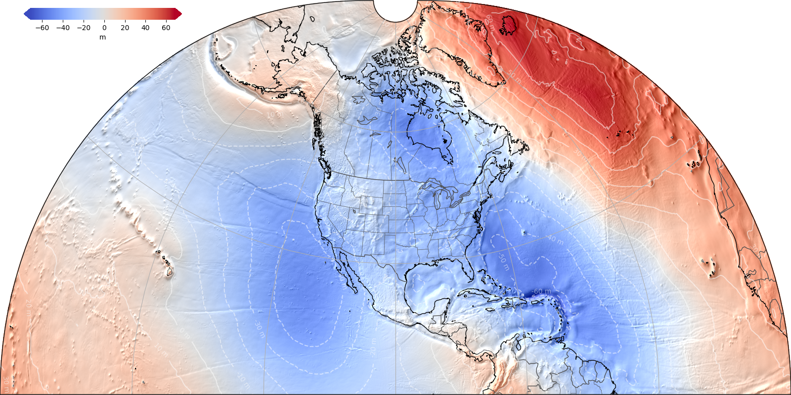
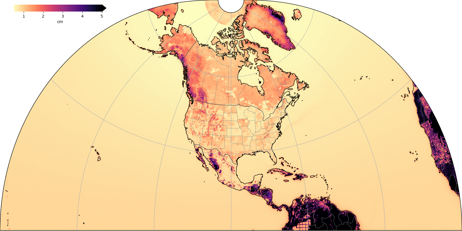
Figure 1: SGEOID2022 Alpha geoid undulation

Map of GEOID2022 Alpha Geoid undulation in red and blue. select this link for a higher resolution version.

Figure 2: SGEOID2022 Alpha estimated 1-sigma uncertainties

Map of GEOID2022 Alpha estimated 1-sigma uncertainties, select this link for a higher resolution version.

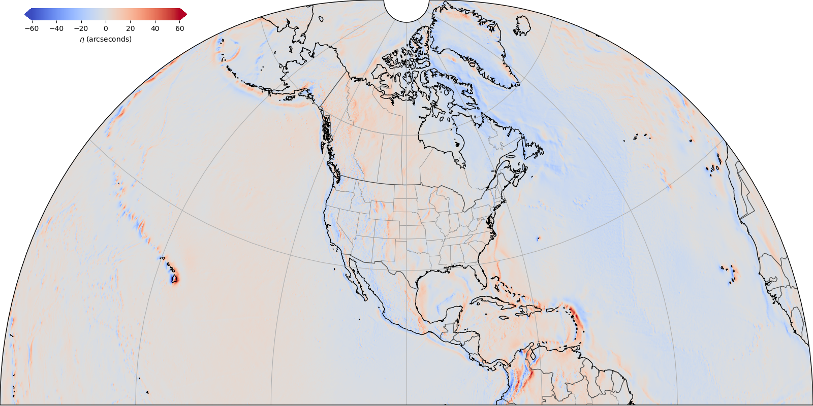
Figure 3: SDEFLEC2022 Alpha surface deflection of the vertical east-west component (eta)

Map of GEOID2022 Alpha surface deflection of the vertical east-west component (eta), select this link for a higher resolution version.

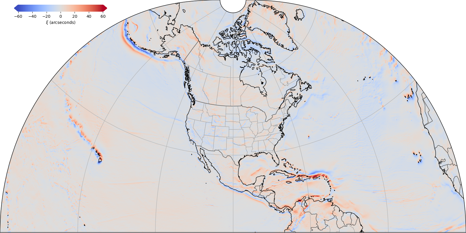
Figure 4: SDEFLEC2022 Alpha surface deflection of the vertical north-south component (xi)

Map of GEOID2022 Alpha surface deflection of the vertical north-south component (xi), select this link for a higher resolution version.

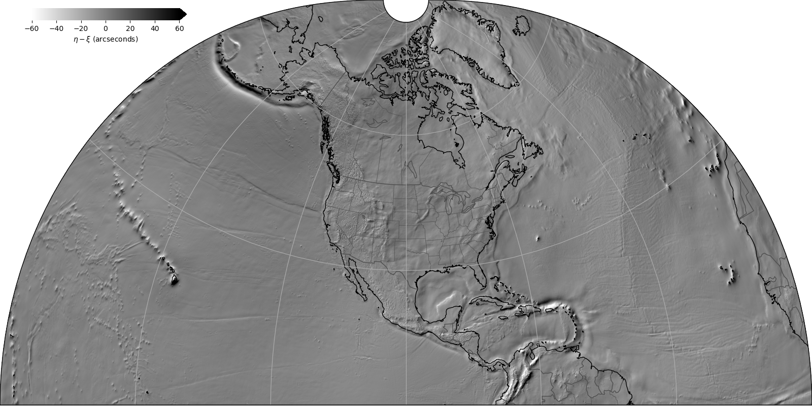
Figure 5: SGEOID2022 Alpha surface relief visualization (based on eta minus xi)

Map of GEOID2022 Alpha surface relief visualization (based on eta minus xi), select this link for a higher resolution version.

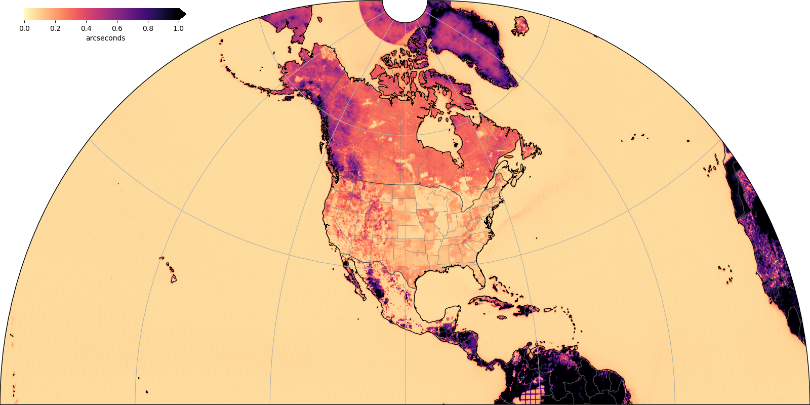
Figure 6: SDEFLEC2022 Alpha surface deflection of the vertical RMS error (any direction)

Map of GEOID2022 Alpha surface deflection of the vertical RMS error (any direction), select this link for a higher resolution version.

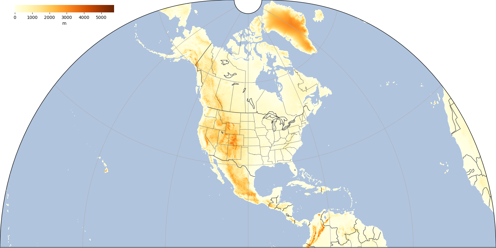
Figure 7: xDEM20 digital elevation model

Map of xDEM20 digital elevation model, select this link for a higher resolution version.

Figure 8: DGEOID2022 Alpha, the dynamic component of the geoid

Map of GEOID2022 Alpha the dynamic component of the geoid, select this link for a higher resolution version.