Content last updated 7/12/2023
State Plane Coordinate System of 2022 (SPCS2022)
SPCS2022 is the third generation of SPCS. The first version was created in the 1930s (SPCS 27) and the second in the 1980s (SPCS 83) as part of providing access to the horizontal datums current at the time of their creation. SPCS2022 will be referenced to the four 2022 Terrestrial Reference Frames that will be released as part of NGS National Spatial Reference System (NSRS) Modernization.
Although this is a preliminary version of SPCS2022, NGS will only make relatively minor changes going forward. The period for making requests, submitting proposals, and providing zone designs ended in 2021. In addition, changes to zone designs must be requested by recognized stakeholder groups, as described in the SPCS2022 Policy and Procedures. General information about SPCS, including its existing and previous versions, is available on the SPCS website.
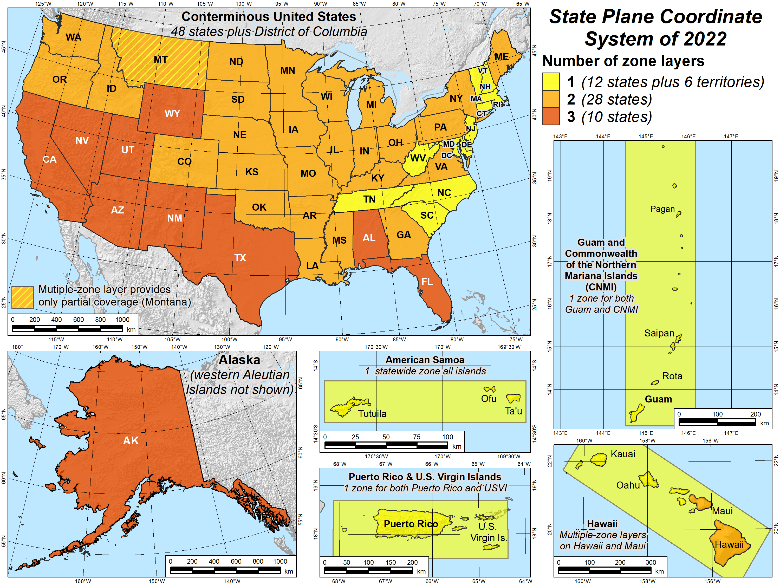
The maps below show that SPCS2022 will have up to three zone layers in each state, and the number of zones will vary greatly between states (click on the maps to get higher resolution versions). Every U.S. state and territory will have a statewide zone. Most states will also have a multiple-zone layer that covers the entire state, and some states will also have a multiple-zone layer that covers only part of the state. In addition, there will be three “special use” zones that each cover more than one state.
Number of zone layers per state
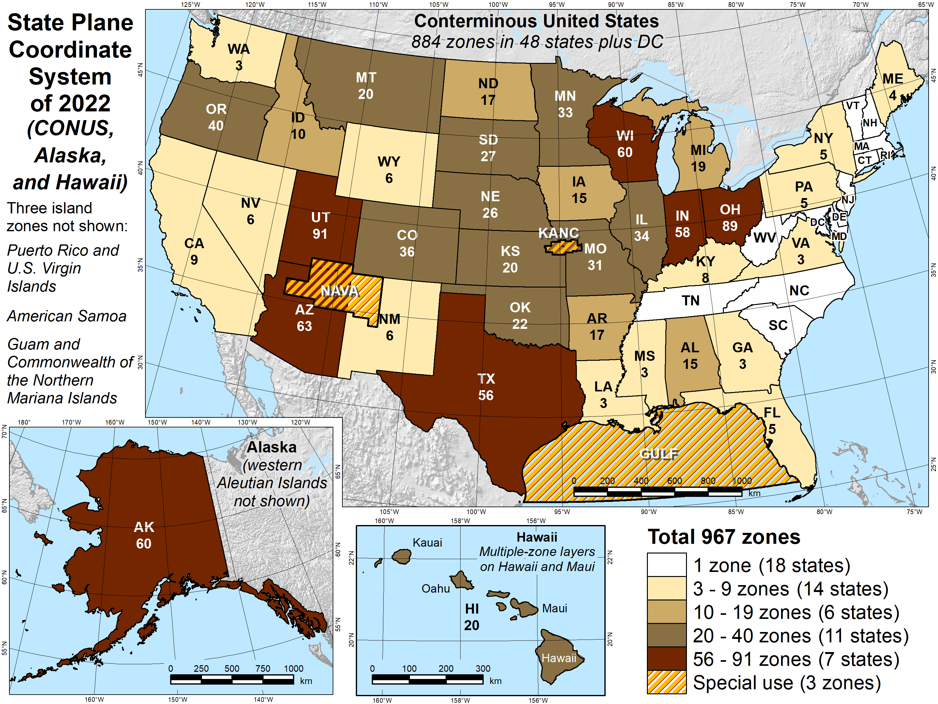
Number of zones per state
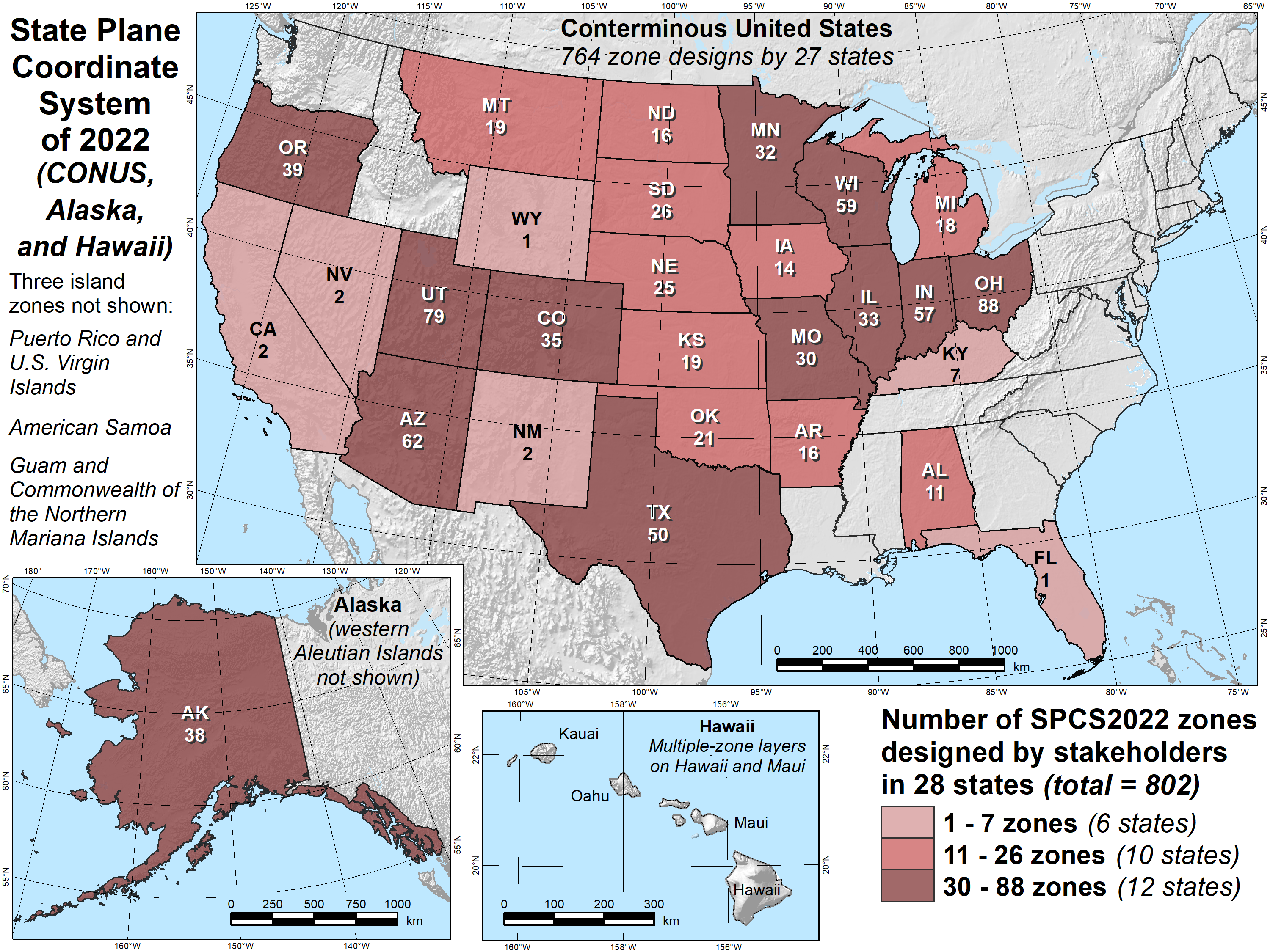
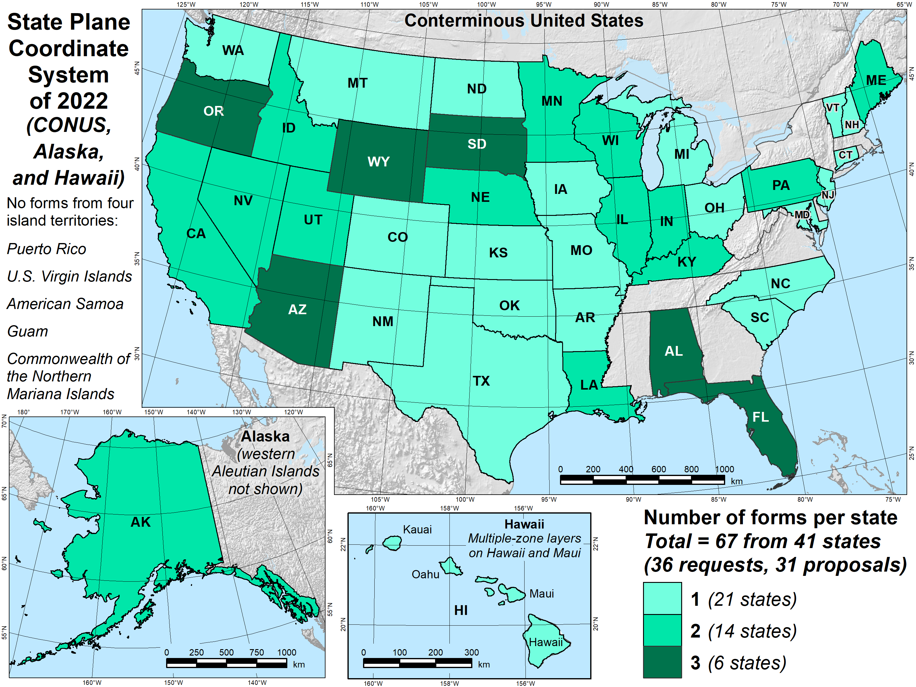
The reason for large variation in the number of layers and zones is that stakeholders in many states actively participated in the SPCS2022 design process. The maps below show that 41 states submitted 67 requests and/or proposal forms for SPCS2022 zones. Requests were for zones designed by NGS, and proposals were for zones designed by stakeholders. Proposals were reviewed and approved by NGS, resulting in 28 states designing their own zones.
Number of state requests and proposals
Number of zones designed by states